详细说明
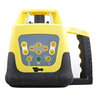
Product Name: Sokkia Survey Gnss Rtk Gxc2 base and Rover Model NO.: GXC2 Accuracy: Accracy Rtk: H:10mm V:15mm Weight: 375g Internal Memory: 8GB Water and Dust Proof: IP67 Communication Ports: Bluetooth, USB 2.0 High Speed Device Rtk Communication: Through Cell Enabled Field Controllers Trademark: Sokkia Transport Package: Standard Export Carton Specification: 48cm*42cm*42cm 11*11*143 cm Origin: USA HS Code: 9031809090 Product Description Sokkia GCX2 GNSS RTK Integrated Receiver (GCX2)The GCX2 is the latest GNSS integrated receiver designed for lightweight and convenient field operation exclusively created for Sokkia. "Nicknamed 'the bullet', the GCX2 exemplifies a completely reimagined approach to receiver design that offers an ultra-lightweight and ergonomic solution at a low cost.This multi-constellation and dual frequency receiver is designed to offer affordable high-quality results for traditional applications in the surveying and construction fields as well as unconventional utilizations such as in landscape architecture, GIS, BIM and forensic mapping.The innovative POST™ (Precision Orbital Satellite Technology) antenna element allows for a form that is both ergonomic and extremely lightweight, which fully differentiates it from existing receivers in the market. The unique 'bullet' shape appears as a small extension of the range pole almost as if it's not even there."The GCX2 may be paired with the Sokkia S-10 cellular-enabled data-controller along with MAGNET Enterprise to provide an easy, lightweight, efficient, and productive rover network solution. The GCX2 can be used with wireless multi-channel Long-Range Bluetooth technology RTK corrections to over 300 m (1000 ft) using up to 3 concurrent rovers as well as a static receiver.Specifications:Dual frequency and multi-constellation GNSS RTK receiverCompact, lightweight, rugged, and cable-free designBluetooth® and wireless multi-channel Long-Range Bluetooth technology RTK correctionsSimplified user displayPrecision Orbital Satellite Technology (POST) integrated antenna226 Channels with optimized satellite tracking technologyNumber of Channels226 Channels with optimized satellite tracking technologyTracked SignalsGPS L1 C/A, L1C, L2P, L2CGLonASS L1 C/A, L1P, L2 C/A, L2PSBAS L1 C/A WAAS/MSAS/EGNOSQZSS L1 C/A, L1C, L2CGAGANMemoryInternal non-removable memory up to 8GBCommunication PortsBluetooth®USB 2.0 high speed deviceRTK CommunicationOver 300 m with up to 3 simultaneous rovers (wireless multi-channel Long-Range Bluetooth technology RTK corrections)Weight (including batteries)13 oz. (375 g)Dimensions (w x h x l)1.9" x 7.3" x 1.9" (47 x 184.5 x 47 mm)Operating TimeAll day operation in any configurations (up to 12 hours)AccuracyStatic/Fast Static:H: 3.0 mm + 0.4 ppm / V: 5.0 mm + 0.6 ppmPrecision Static:H: 3.0 mm + 0.1 ppm / V: 3.5 mm + 0.4 ppm *RTK (L1+L2):H: 10 mm + 0.8 ppm / V: 15 mm + 1.0 ppmPictures: