详细说明
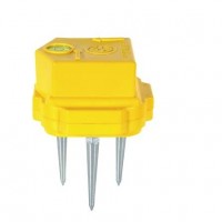
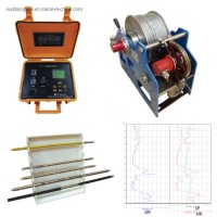
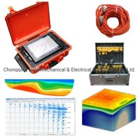
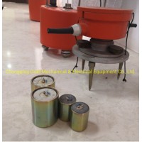
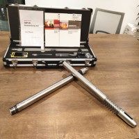
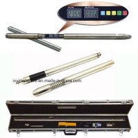
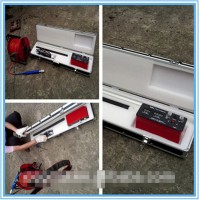
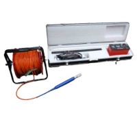
Product Name: Geographic Surveying Instrument, Electrical Resistivity Meter Geophysical Equipment, Electrical Resistivity Tomograph Geological Equipment for Sale Model NO.: DZD-6A Geophysical Equipment Horizontal Line: 4 Vertical Lines: 4 Accuracy: <1mm Type: Geographic Surveying Instrument Maximum Measuring Voltage: -6000mv~+6000mv Measuring Voltage Resolution: 0.01 Mv Suppression on 50Hz Power Frequency: 80dB Measuring Current: 0~5000 Ma Method: Resistivity Meter for Ground Water Exploration Principle: Geophysical Resistivity Meter Product: Geophysical Equipment Instrument: Geological Equipment Use: Underground Water Detector Trademark: Gold Transport Package: Wooden Case Origin: China HS Code: 9030399008 Product Description Geographic Surveying Instrument, Resistivity Meter for ground water exploration, Geophysical Equipment, Electrical Resistivity Tomograph, groundwater finder Functions:This Geographic Surveying Instrument can be used in energy exploration and civil geophysical prospecting, railway and bridge survey, mental and non-mental mineral survey. It can also be used in hydro- and engineering geology survey, such as underground water, water reservoir dam site, flood control dam hidden trouble detection, and geothermic field survey.Main Applications:Normal DC resistivity and IP measurement.2-D multi-electrode resistivity3-D multi-electrode resistivityTechnical Specification:DUK-2AGeographic Surveying InstrumentConversion electrodes60 channels or 120 channelsOperating mode16-key keypad with 90 character LCD display combines to form man-machine dialogue operationMaximum allowable current2AMaximum withstand voltage500V DCInsulating property500M ohmWorking temperature-10ºC~ +50ºCWeight7kg (60 channels)/ 7.5kg (120 channels)Volume (mm)305*200*202 (60 channels)/ 324*200*245 (120 channels)Geographic Surveying Instrument, Resistivity Meter for ground water exploration, Geophysical Equipment, Electrical Resistivity Tomograph, groundwater finder