详细说明
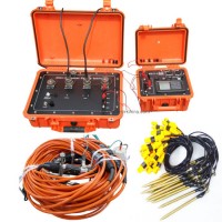
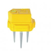
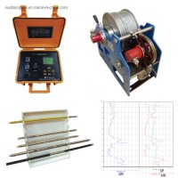
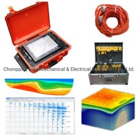
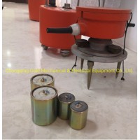
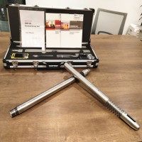
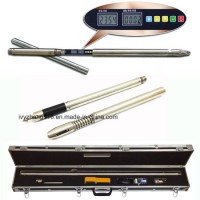
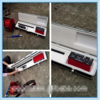
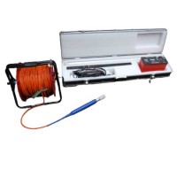
Product Name: Geographic Geophysical Resistivity Surveying Instrument Electrical Resistivity Tomography Equipment Ground Water Detector Underground Water Detection Model NO.: DUK-2A Geophysical Resistivity meter Field: Geophysical Equipment Usage: Ground Water Detector Method: Geo Tomography Method 2: Electric Tomography Method3: Resistivity Imaging Application: Groundwater Exploration Trademark: Gold Transport Package: Wooden Case Specification: ISO Origin: China HS Code: 9031809090 Product Description Geographic Surveying Instrument,Resistivity Imaging, Geo Tomography, Electric Resistivity Tomograph,Ground Water Detector, Underground Water Detection for Sale Main ApplicationsThis Geographic Surveying Instrumentcan be used in energy exploration and civil geophysical prospecting, railway and bridge survey, mental and non-mental mineral survey. It can also be used in hydro- and engineering geology survey, such as underground water, water reservoir dam site, flood control dam hidden trouble detection, and geothermic field survey.Resistivity imaging, also known as electrical resistivity tomography (ERT) is a particularly useful survey method in clayey ground, where techniques such as Ground Penetrating Radar (GPR) are less effective. The method can also help to identify transitional boundaries in subsurface layers that can be difficult to detect using other geophysical methods and is a useful tool for locating deep seated sinkholes and mine workingsMain Features.normal DC resistivity and IP measurement.2-D multi-electrode resistivity Imaging3-D multi-electrode resistivity imagingGeographic Geophysical Resistivity Surveying Instrument Electrical Resistivity Tomography Equipment Ground Water Detector Underground Water DetectionTechnical SpecificationsReceiverVoltage channel:±6VSurvey accuracy: if Vp≥10 mV then ± 5‰ ± 1 LSB, if Vp < 10 mV, then ±1% ± 1 LSBCurrent: 5ASurvey precision: if IP≥ 10mA then ± 5‰ ± 1 LSB, if IP < 10 mA, then ±1% ± 1 LSBapparent resistivity measurement accuracy: ±1% ±1 LSBdepression is more than 80dB for 50Hz industrial interference (common mode or different mode interference)input impedance: ≥50MΩTransmittermaximum supply voltage: 900V(800V for distributed multi-electrode resistivity )maximum supply current: 5AGeographic Geophysical Resistivity Surveying Instrument Electrical Resistivity Tomography Equipment Ground Water Detector Underground Water Detection Geographic Resistivity Surveying Instrument, Electrical Resistivity Tomography Equipment, Ground Water Detector, Underground Water Detection